

You can find on this page the blank map of Bulgaria to print and to download in PDF. The contours map of Bulgaria presents the international boundary of Bulgaria in Eastern Europe. You can use the vector map of Bulgaria for personal or educational use.
The blank map of Bulgaria shows the country Bulgaria empty. This blank map of Bulgaria will allow you to use the map for personal activities or educational with children for example (drawing). The empty map of Bulgaria is downloadable in PDF, printable and free.
Bulgaria is located in Europe, where is shares a border with five other countries as you can see in the Blank map of Bulgaria. Its shared border with Romania is the longest, and is marked by the Danube River. Along with those countries, Bulgaria also shares part of its border with the Black Sea. The capital is Sofia, which also serves as its largest city, containing 1/7th of the countries entire population. A relatively small country in Europe, is territory covers slightly less than 43,000 square feet.
Bulgaria has a total border of about 2,264 km. Rivers account for about 680 km and the Black Sea coast for 400 km; the southern and western borders are mainly defined by ridges in high terrain as its shown in the Blank map of Bulgaria. The western and northern boundaries are shared with Serbia and Romania, respectively, and the Black Sea coastline constitutes the entire eastern border. The Romanian border follows the Danube for 464 km from the northwestern corner of the country to the city of Silistra and then cuts to the east-southeast for 136 km. The Danube, with steep bluffs on the Bulgarian side and a wide area of swamps and marshes on the Romanian side, is one of the most effective river boundaries in Europe.
Bulgaria political geography has changed greatly since the restoration of statehood in 1878. Russia, whose military victories had led to its creation, pushed for a "big Bulgaria" that would include much of Macedonia. At the Congress of Berlin, however, the powers insisted upon a much reduced area, divided until 1885 between the principalities of Bulgaria proper and Eastern Rumelia as its mentioned in the Blank map of Bulgaria. An independent kingdom from 1908 to 1946 and thereafter a republic, Bulgaria sought to expand its territory in the two Balkan Wars of 1912-13 and in World Wars I and II. Defeat in the last three conflicts led to a large loss of territory in 1913 and 1919, though the 1940 recovery of the Southern Dobruja was confirmed by the Paris Peace Treaty of 1947.
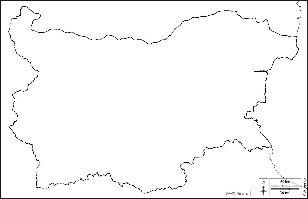
The Bulgaria map outline shows all the contours and international boundary of Bulgaria. This outline map of Bulgaria will allow you to easily learn about neighboring countries of Bulgaria in Eastern Europe. The Bulgaria contours map is downloadable in PDF, printable and free.
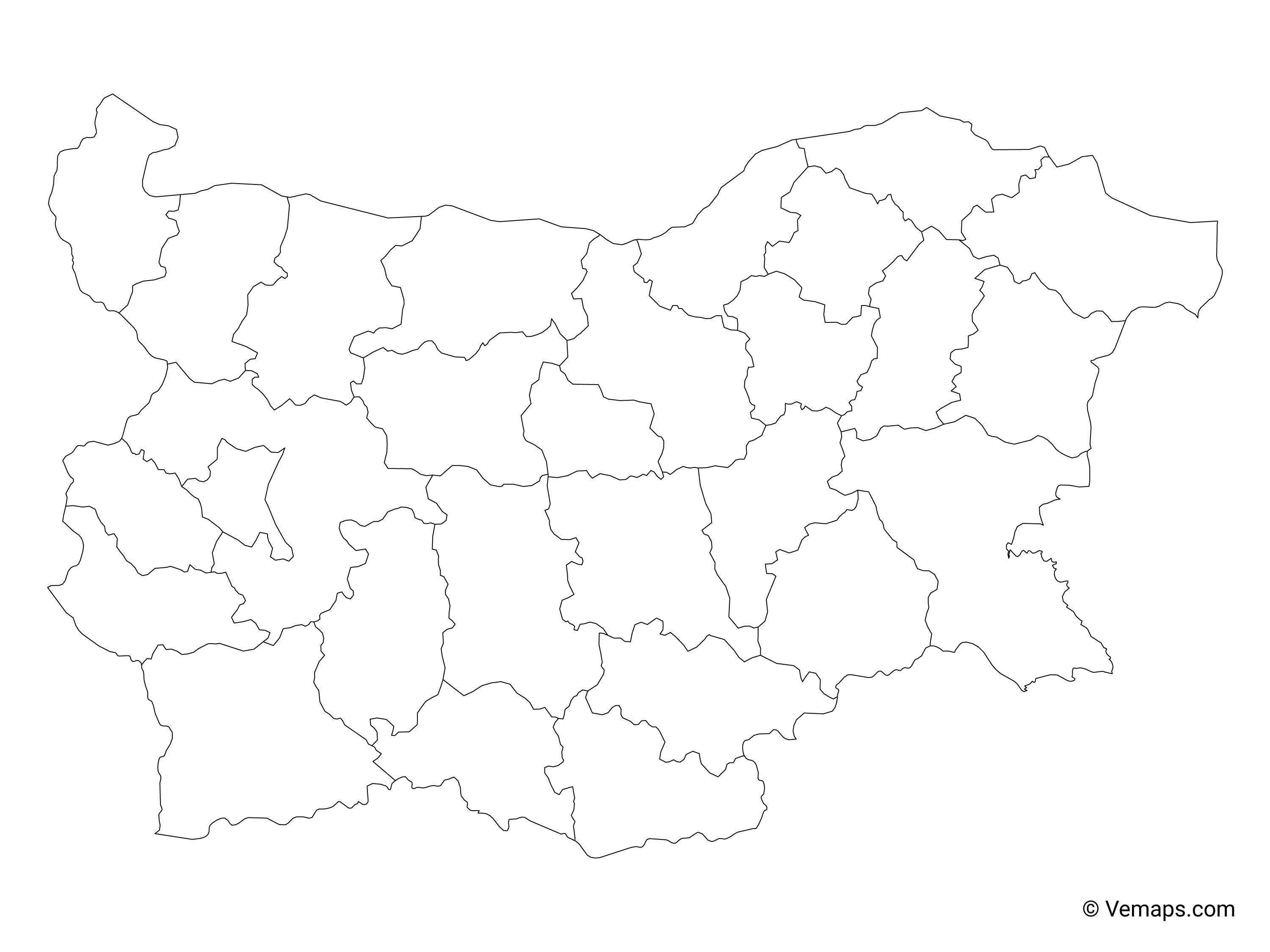
The above outline map represents Bulgaria, a southeast European nation. As can be observed in the map, Bulgaria has a rough rectangular outline. Bulgaria, one of the newest members of the European Union, has 28 provinces. The provinces stretch over a relatively large area and have borders with countries as distinct as Romania, Serbia, North Macedonia, Greece, and Turkey. The largest region is Sofia, with a population of over one million, and located in the East. The west coast cities of Varna and Burgas, located on the Black Sea, are fast becoming popular vacation spots because of the sunny beaches and affordable prices.
In Bulgaria map outlines, the provincial divisions of the country and their capitals are shown in clear format. The boundaries of the country are also indicated in the map. The capital of Bulgaria is Sofia. It is located in the western region of Bulgaria. Covering 190 square miles, and with an estimated population of 1.27 million, Sofia is the largest city in Bulgaria. Bulgaria map outlines highlights the provincial divisions of the country and their capitals, major cities, and the provincial and international boundaries of the nation.
Bulgaria is divided into twenty-seven provinces that are further divided into 264 municipalities. The provinces as you can see in Bulgaria map outlines are: Blagoevgrad, Burgas, Dobrich, Gabrovo, Haskovo, Kardzhali, Kyustendil, Lovech, Montana, Pazardzhik, Pernik, Pleven, Plovdiv, Razgrad, Rousse, Shumen, Silistra, Sliven, Smolyan, Sofia Province, Stara Zagora, Targovishte, Varna, Veliko Tarnovo, Vidin, Vratsa, and Yambol.
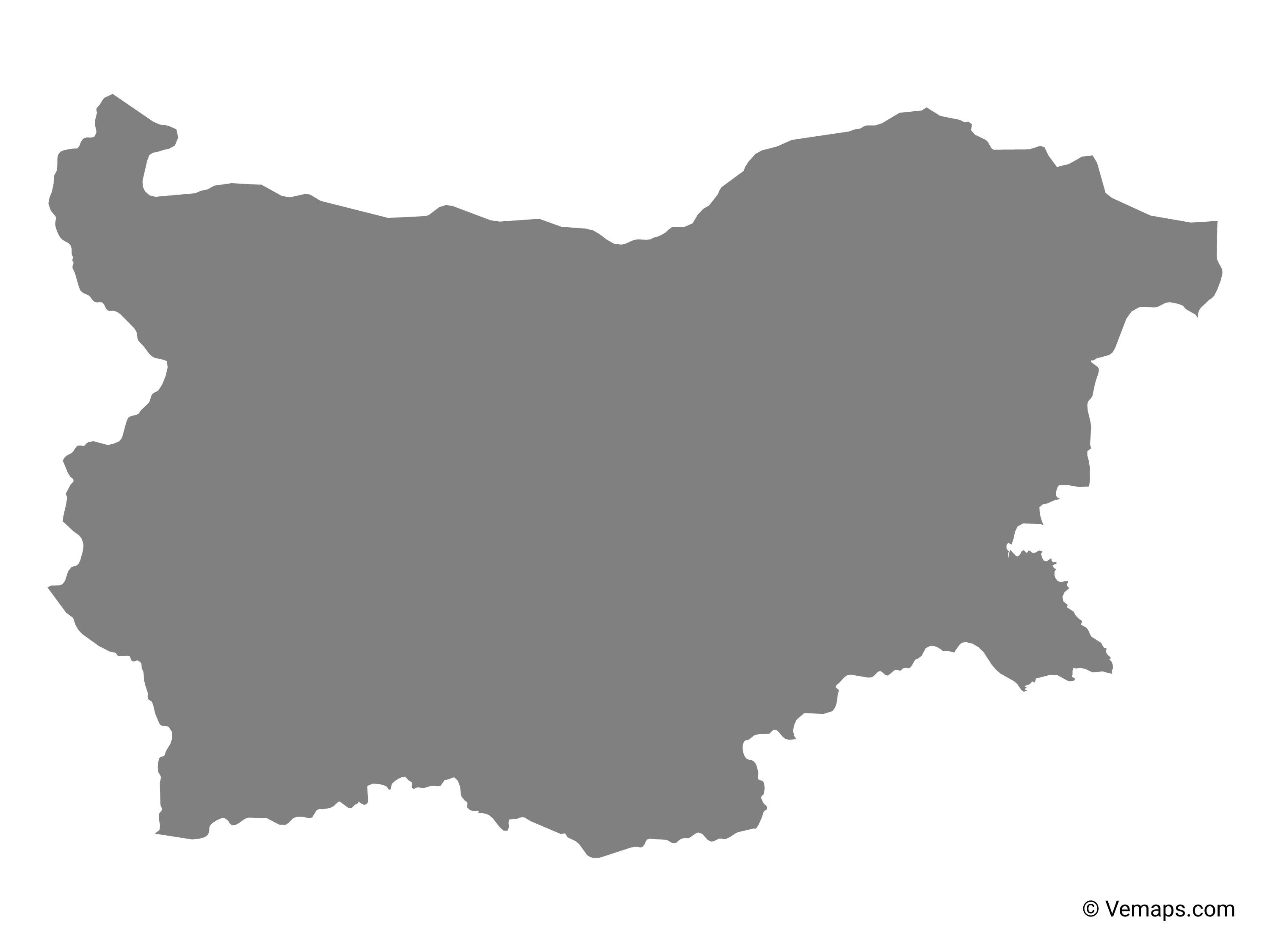
The vector map of Bulgaria shows entire surface of Bulgaria empty. This vector map of Bulgaria will allow you to make changes or add details to the map of Bulgaria in Eastern Europe, for personal or educational purposes. The vectorial map of Bulgaria is downloadable in PDF, printable and free.
Bulgaria is a parliamentary democracy. The Prime Minister is the head of government; Boyko Borisov is the current Prime Minister. Georgi Parvanov is the President of Bulgaria. Bulgaria is the oldest country in Europe that has not changed its name since it was first established. This happened in 681 AD. Sofia, the capital of Bulgaria, was founded 7000 years ago as its mentioned in Bulgaria map vector. This makes it the second oldest city in Europe. The gold treasure discovered in the Varna Necropolis is the oldest one in the world. It dates back to 5000 BC. Bulgaria comes third in the list of countries with most valuable archaeological sites discovered on their territories, preceded only by Greece and Italy.
Over 15 000 Thracian tombs have been discovered on the territory of Bulgaria as you can see in Bulgaria map vector. The bulk of them are yet to be explored. There is solid historical evidence that wine has been produced on the territory of what is now modern-day Bulgaria ever since the Stone Age. Today the country has earned the reputation of a world-class wine producer. Every year on 1 March Bulgarians exchange martenitsas. Essentially, these are small pieces of adornment made of red and white thread that symbolise good health and happiness.
Nearly one third of Bulgaria is covered in forests and this should not be too surprising given the fact that there are over 40 mountains on its territory as its shown in Bulgaria map vector. Needless to say, they are all great for skiing and mountaineering. Bulgaria is the country with the highest number of natural mineral springs in Continental Europe – over 600. The different ethnic and religious groups in Bulgaria live in peaceful coexistence. The Bulgarian army has never lost a single flag in battle. The Bulgarian national football team finished fourth in the 1994 World Cup. Their best footballer, Hristo Stoichkov, finished the tournament as a top scorer, netting six goals in seven games. Later that year, he also went on to become the first Bulgarian player to win the Ballon d’Or.